Damara Project, Namibia
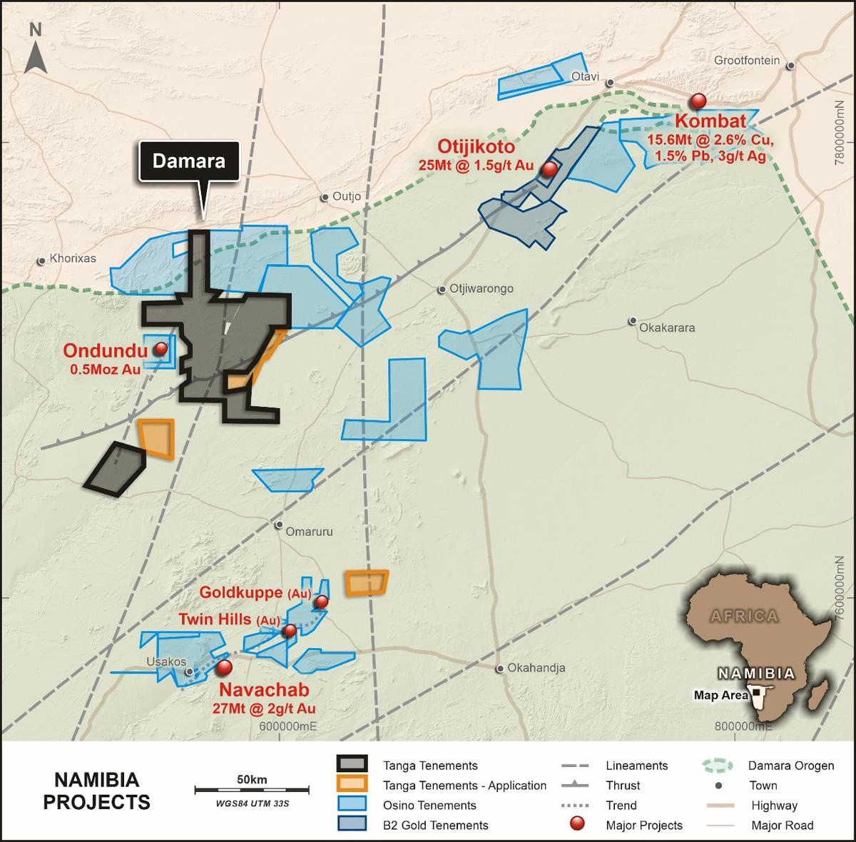
The Damara Project is located in central Namibia some 60km to the south-west of the town of Outjo and 100km west of the town of Otjiwarongo. The project is easily accessed by all-weather roads to either Otjiwarongo or Outjo and then via a series of well-maintained gravel and farm roads to the project area.
The project consists of 11 licences for a total of approximately 3,100km2.
This landholding is significant in the first instance because large contiguous landholdings on the Damara belt are rare – tenure is usually fragmented and also because the tenements surround the B2Gold Ondundu deposit and are bordered to the north by Osino Resources.
Geology
The Damara Project covers the major north-east trending Otjihorongo Thrust and the north-northeast trending Welwitschia Lineament which is known to host structurally controlled copper deposits, previously drill tested by WIA, in the north of the project area, on the Hagenhof licence.
Conceptual targets in Namibia are usually intimately associated with intrusive rocks and are often pyrrhotite bearing, hence these targets are frequently characterised by magnetic highs. As such, the Company has placed an emphasis on identifying magnetic features at significant structural intersections that may signal intrusions related to mineralisation. First pass reconnaissance exploration consists of soil geochemistry with anomalies usually followed up by mapping, rock chip geochemistry and finally ground magnetics.
Stratigraphy
The project stratigraphy is centred around the regional Okonguarri Anticline. Rocks within the anticline belong to the Okonguarri formation which consists of a series of interbedded siliciclastic, calcareous and dolomitic turbidites and are estimated to be around 4,600m thich within the Okonguarri anticline. These rocks are overlain by the Ghaub formation diamictite, some tens of metres thick, with a cap carbonate which is a 1-3m thick, tan to dark brown silty dolomite. The Ghaub formation is in turn overlain by the Kuiseb formation which is the highest unit of the Swakop Group and may attain a thickness of up to 10km. The Kuiseb formation in the project area consists of quartz-albite-chlorite-muscovite schists which represent metapelites and metagreywackes.
